Showing posts with label Pinta Trail. Show all posts

Friday, April 10, 2015

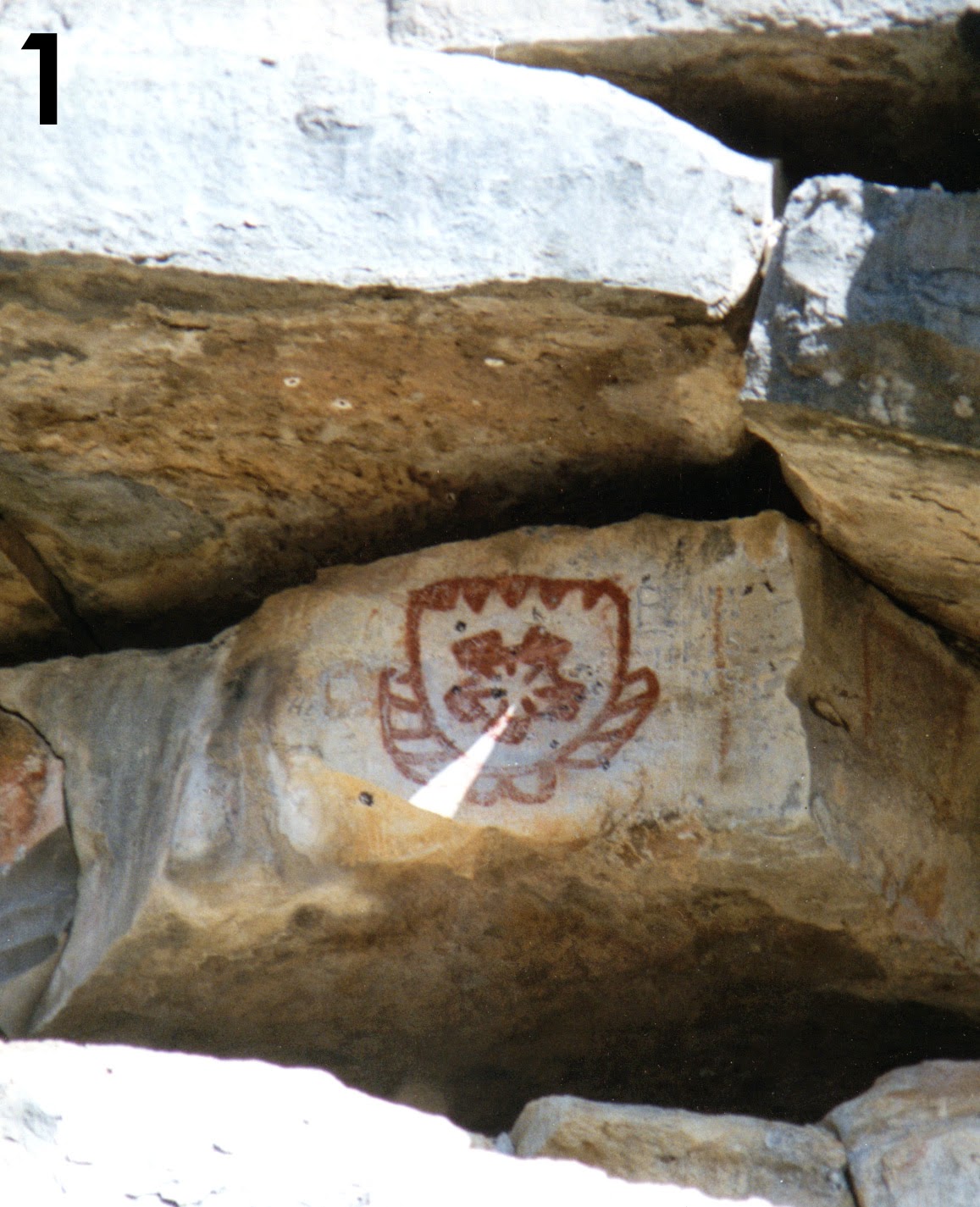
Pictographs at Paint Rock May Act as Solar Calendar

Photo from "A Central Texas Sun Dagger", Robert Robbins press release, 1999


Along the Pinta Trail running north-south west of Austin is a large pictograph site known as Paint Rock. Pictographs at Paint Rock may act as a solar calendar, marking solstice.

Listen to a Texas Public Radio interview with Gordon Houston, PhD candidate in archaeoastronomy, about the site:

Texas Public Radio article


  • " .. Until recently the intricate symbols were thought to be static and not interacting with the environment. But this is no longer the case, for some pictographs near Paint Rock Texas, east of San Angelo have revealed their ancient secret. We now know some of these symbols mark the solar solstice and equinox with astonishing accuracy.."

The possibility that pictographs at Paint Rock may have been used as a solar calendar was first discussed in a paper from 1999 given to the American Astronomical Society in Austin, Texas, by R. Robert Robbins of the University of Texas Astronomy Department at Austin; click on link:

A CENTRAL TEXAS SUN DAGGER

Sunday, April 5, 2015

Cross Mountain, Fredericksburg, on the Pinta Trail

Cross Mountain lay on the Pinta Trail, west of Austin, running north out of San Antonio, through Fredericksburg, north to the area of the San Saba Mission in Menard, TX. Cross Mountain has a tradition of being a Comanche signal hill, a conical shape hill with visibility in 360 degrees. Great for seeing, great for being seen, as in signal fires, AKA smoke signals.

The Texas Historical Commission marker at the base of Cross Mountain reads:
Cross Mountain. This marl and limestone hill, elevation 1,915 feet, was an Indian signal point, advancing news of the intrusions of white settlers. The hill was first recorded and described by the German geologist, Dr. Ferdinand Roemer in 1847. A timber cross found on the hilltop the same year suggests that Spanish missionaries recognized it as a landmark on the path from San Antonio to Mission San Saba. John Christian Durst (1825-1898), arriving with his family in 1847 from Germany, received a town lot and 10 acres of land, including this hill. On finding the cross, he named it "Kreuzberg," or Cross Mountain. The Easter fires on Cross Mountain and the surrounding hills recall a German tradition of burning the old growth to make way for the new, and also commemorate the 1847 treaty made by John O. Meusebach and the settlers to establish peace with the Comanche nation. 
In 1849, a Bohemian priest, Father George Menzel, erected a more substantial cross as a symbol of redemption and civilization. Easter Sunrise Services were held on the mountain for many years prior to 1941. In 1946 the Very Rev. F. X. Wolf threw the switch to illuminate the permanent cross of metal and concrete built by St. Mary's Catholic Church.

Comanches probably had another reason for visiting Cross Mountain: flint, or chert. Near the top of Cross Mountain runs a layer of limestone with nodules of beautiful amber chert.