George W. Davis
One of the first settlers around Spicewood Springs was George Washington Davis (ca. 1809-1884). And the Austin Oaks land is part of the original grant of 3,154 acres for his service to the Republic of Texas during the Texas Revolution (Battle of San Jacinto).We've actually got a couple of history markers east of Shoal Creek relating to the George W. Davis. One deals with the fact that his land was also the site of the quarry from which limestone was taken for the 1853 Texas Capitol; this spot is today's Northwest Park:
https://www.hmdb.org/marker.asp?marker=95577
The other marker is the Davis Cemetery:
https://www.hmdb.org/Marker.asp?Marker=26778
Here's a couple of maps. The first a snippet from the 1880 GLO map of landowners showing Spicewood Springs (purple dot), Spicewood Springs creek that runs down into the Austin Oaks property, across the tracks and into Shoal Creek (green), and Davis' grant (outlined in yellow)
The second map is using TCAD's map search facility to get a better look at George W. Davis' property boundary; Spicewood Springs Road is roughly the northern boundary on this old Republic of Texas Land Grant.
So Austin Oaks is on land granted to a participant of the Battle of San Jacinto by the Republic of Texas for services rendered in the Texas War for Independence. That would sound good on a marker!
Travis County Poor Farm
Click here to view Michael Barnes article
Click here for previous post with more on the Poor Farm
Footnotes
[1] Travis County Clerk Records: Commissioners Court
Minutes D, p 218, describes the purchase by Travis County of 303 acres for the
Poor Farm from the headright of G.W. Davis in 1879. Available on Portal to
Texas History. The western and eastern boundaries of the Poor Farm are shown on
the the Travis County Clerk Records: Road
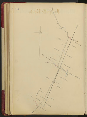
Book Precinct 2, maps for Jollyville Road & Upper Georgetown Road
(today's Burnet Road). This location of the Poor Farm is the one referenced in Wilbarger’s Indian
Depredations of Texas, p. 140, saying Spicewood Springs was "opposite
where the poor farm of Travis county is located".


No comments:
Post a Comment